I work to translate big environmental issues into local contexts, helping people make informed decisions about how their communities should operate and develop. I do this by combining my experience in environmental policy, academic background in earth and biological sciences, and skills in programming and GIS. I thrive at the intersection of environmental science, data analytics, and policy advocacy.
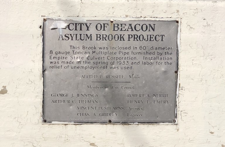
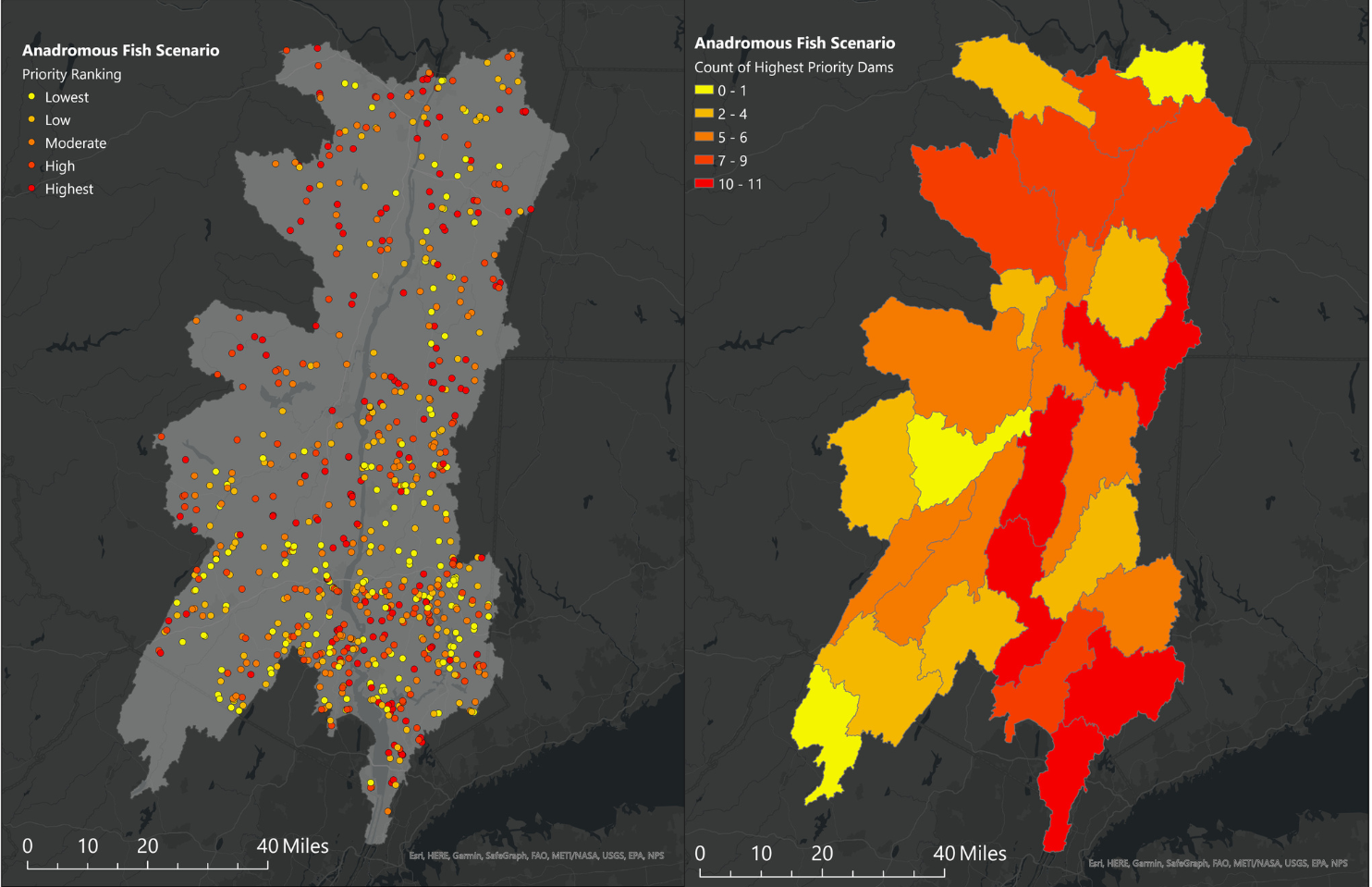
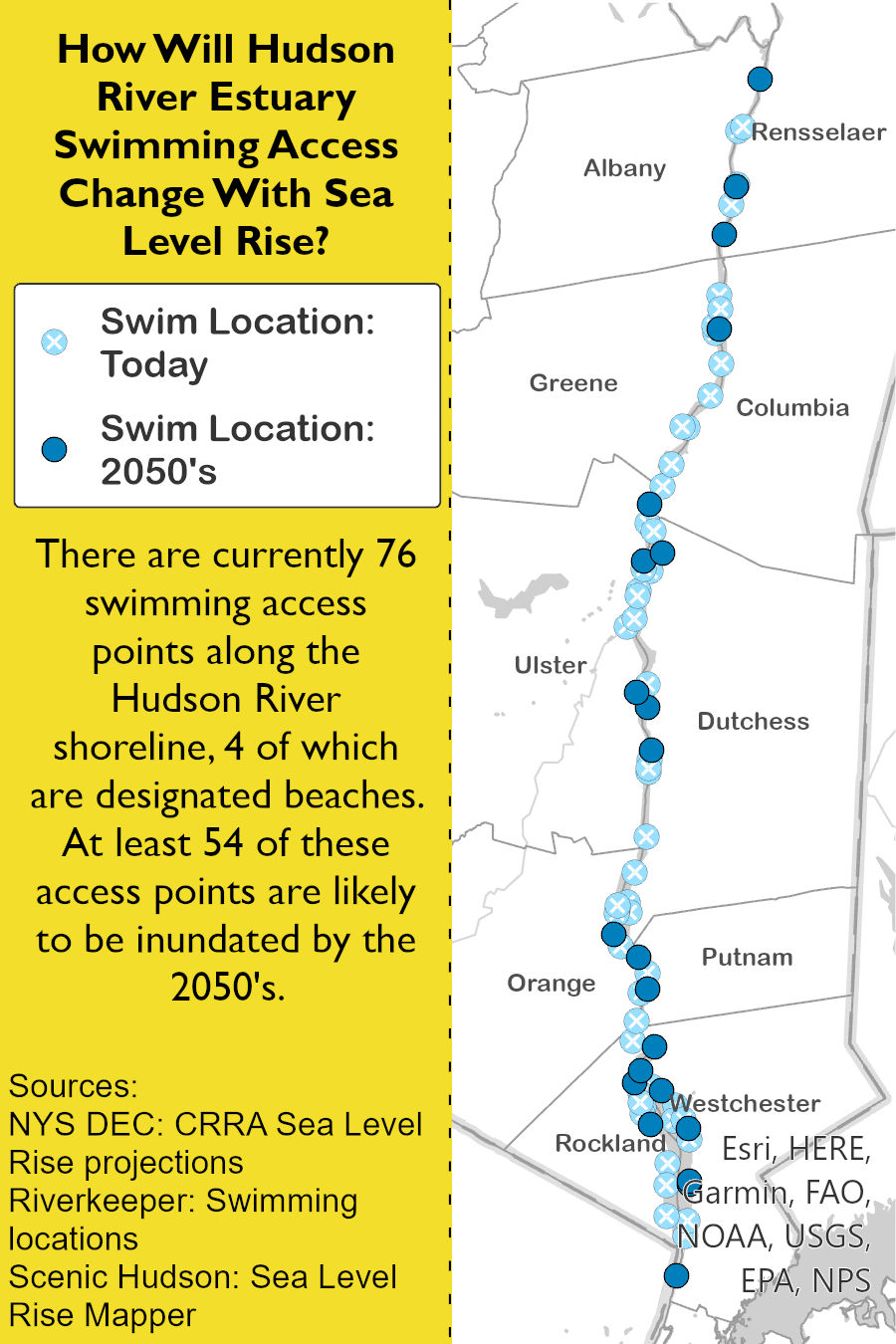
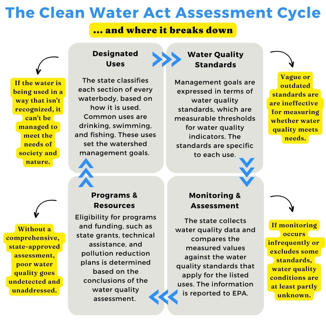
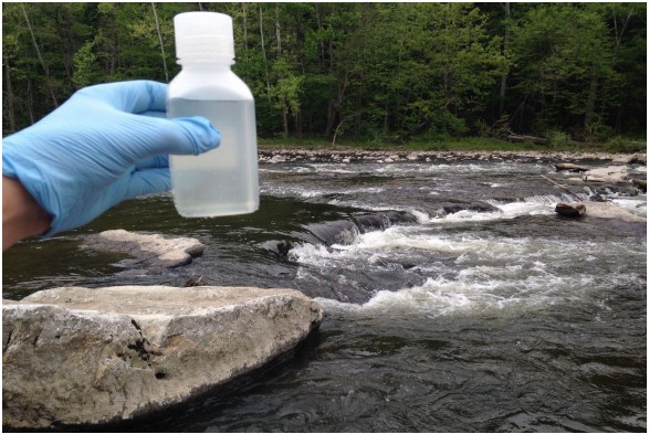
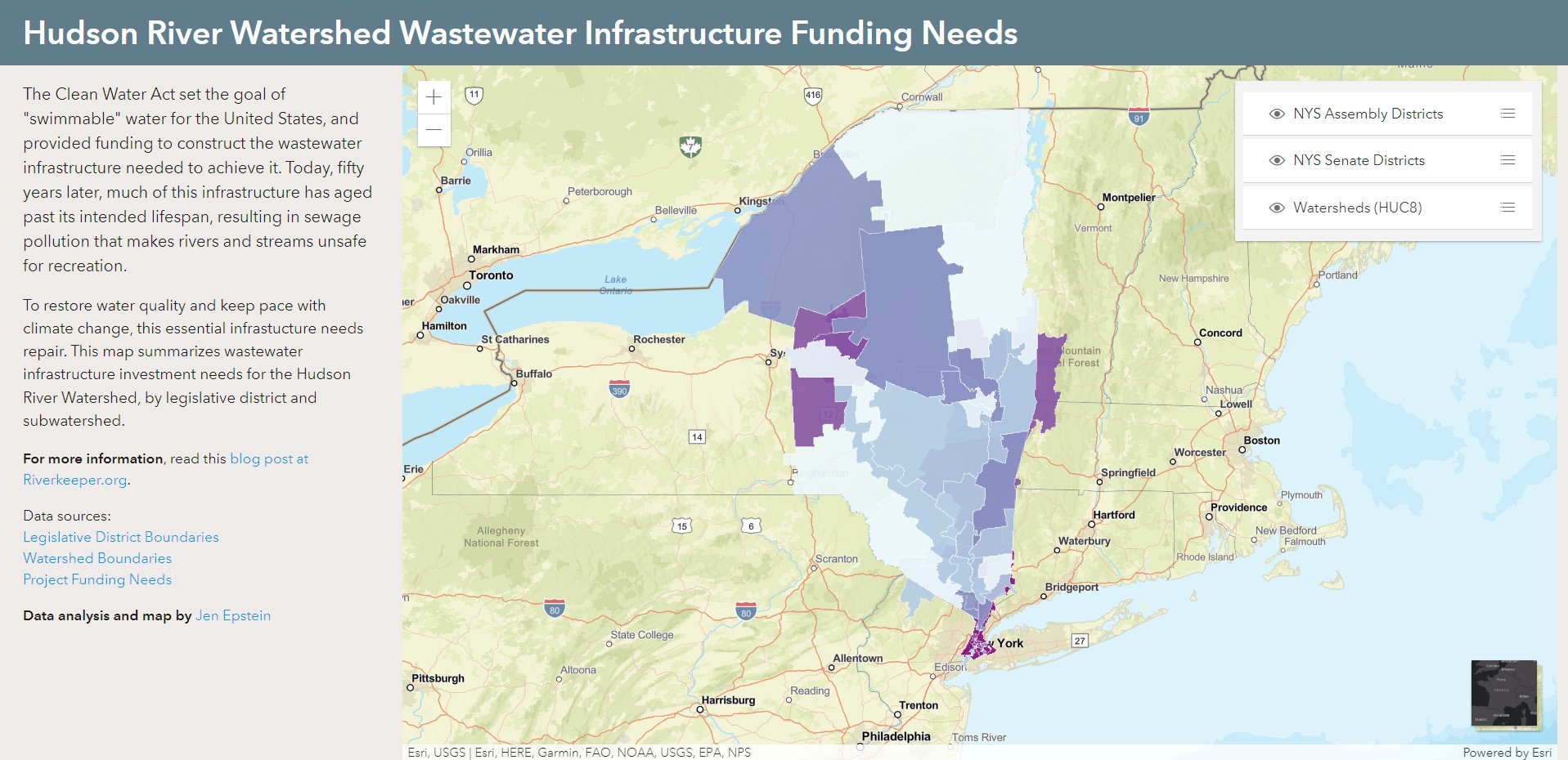
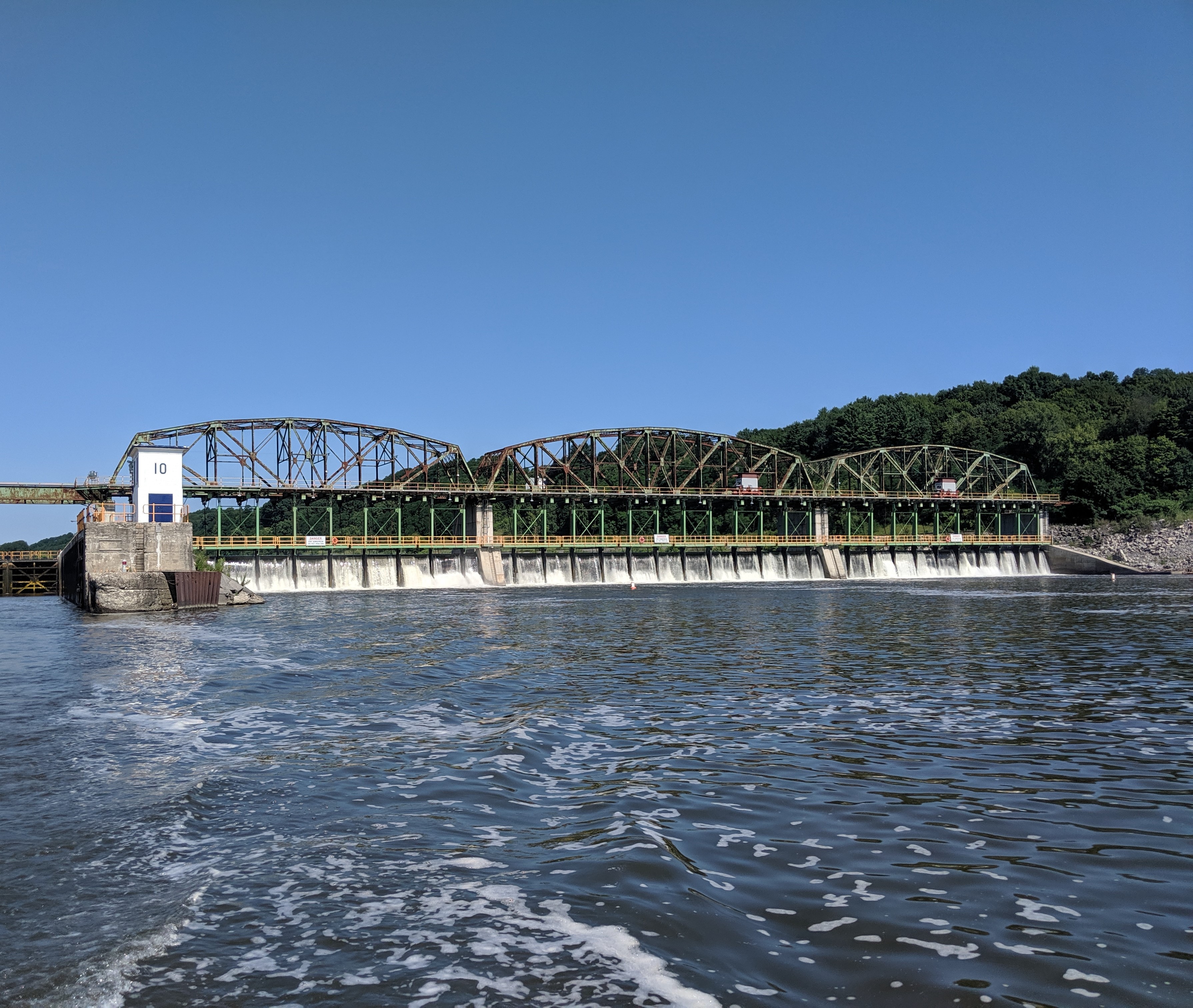
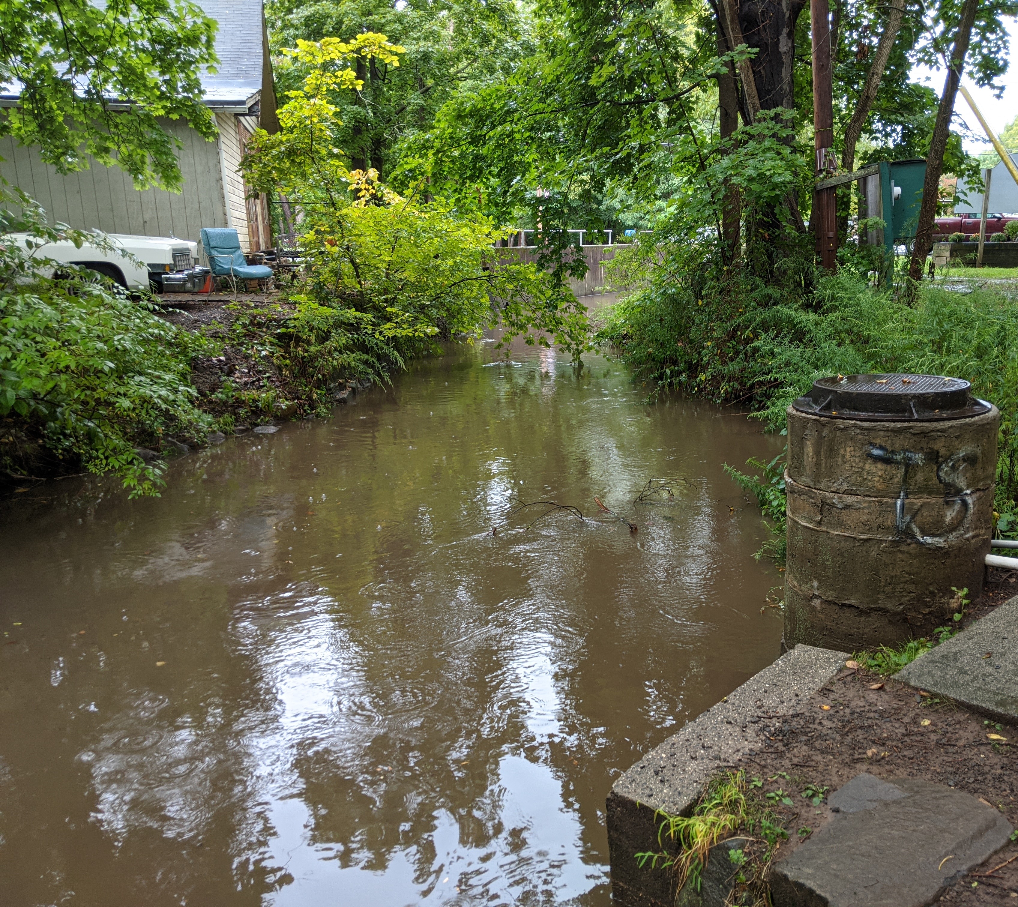
I am driven by an insatiable curiosity about the world and an unquenchable desire to improve systems. My early career focused on freshwater ecology, with field work in rivers and wetlands, and research on water quality in urban streams. I spent several years managing a community-based water quality monitoring program and using the data to advocate for improved wastewater management.
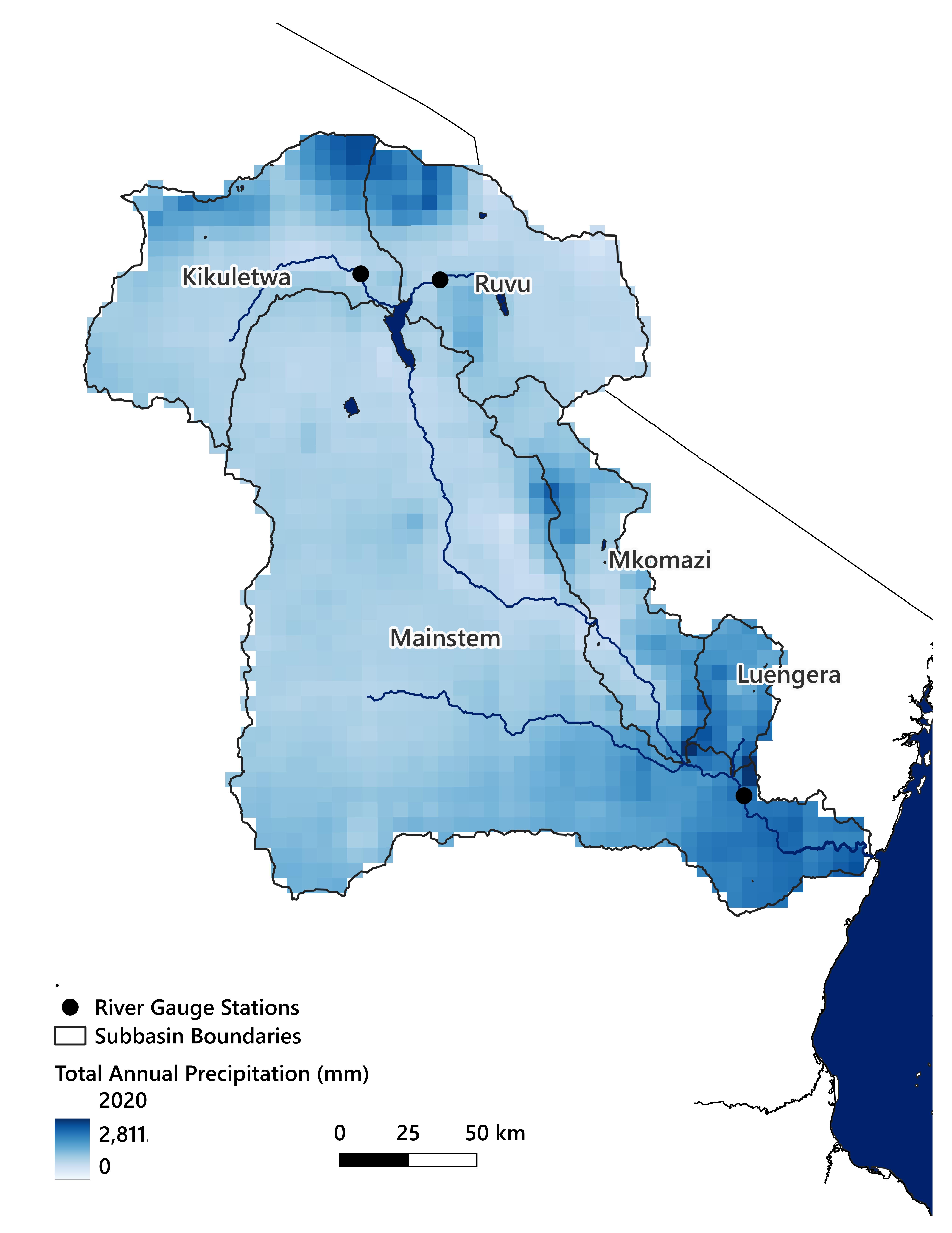
No environmental problem exists in isolation, and I am in my zone when combining data and policy analysis to untangle complex issues. I am especially interested in water, specifically how constructed stormwater, wastewater, and drinking water systems intersect with each other and with natural streams, rivers, and wetlands. I bring an interdisciplinary mindset to every project.
A native of New York's Hudson Valley, I currently live in Arusha, Tanzania, with my husband and two kids. When I am not working, you can find me planning my family's next outdoor adventure, researching genealogy, or reading science fiction.
If my work interests you, feel free to reach out for a chat. I’m always interested in learning from others.
"The Threat of Landfill Leachate to Drinking Water in Hudson/Mohawk Rivers" is a project that I co-founded to examine the interconnections between solid waste landfills and drinking water in the Hudson and Mohawk Watersheds. We have documented how and where approximately 91 million gallons of landfill leachate are diluted and discharged into the Mohawk River and Hudson River Estuary every year. In late 2024 we will release a report, web map, and StoryMap that explain the regulatory loopholes behind this practice and map its impacts in our project area.
Knowledge and Tools Used: QGIS, Postgres, PostGIS, policy analysis, writing
As population growth, climate change, and land use change disrupt hydrological systems and long-standing water use patterns, water stress threatens an increasing number of places. The river basin that I live in is one example, and I used my Master’s Degree in GIS Capstone project as an opportunity to study it. My general goals for this final project were to focus on remote sensing data, modeling, and open-source tools. I explored the potential for an empirical model using only remote sensing data to estimate river flow. My model did reasonably well, showing that the concept has potential as a tool for water management.
Knowledge and Tools Used: Python raster processing libraries, Google Earth Engine, QGIS, Monte Carlo modeling
Asylum Brook is a small stream in the city of Beacon, NY, that was buried in phases during the twentieth century. I researched
its history and created a
Knowledge and Tools Used: Georeferencing, data editing, ArcGIS Pro, ArcGIS StoryMaps, inclusive communications
River dams cause a wide range of negative impacts to flowing waters, and dam removal is an increasingly popular ecological restoration method. Due to the cost and complexity of removals, and the sheer number of dams present in the landscape, it is useful to prioritize dams for removal. I created a spatial model to prioritize dams in the Hudson River Estuary watershed for removal based on potential to restore habitat access.
Knowledge and Tools Used: ArcGIS Pro Trace Networks Toolbox, Python, model validation, model sensitivity analysis
As low-lying shoreline areas are inundated by sea level rise, beaches may become inaccessible due to flooding at access points, even as increased temperatures extend recreational seasons. I analyzed pedestrian and vehicle-based access to swimming areas under current and projected sea levels. This information can help planners ensure equitable future access.
Knowledge and Tools Used: Spatial data analysis, ArcGIS Pro
The Clean Water Act is a 50-year-old U.S. law that was created to ensure that all waters are 'fishable, swimmable, and drinkable.' This infographic highlights the gaps between how the CWA was designed to work, and where it often breaks down. The CWA focuses on what state governments must do, but it also calls for extensive public involvement. One of the overarching solutions to these breakdowns, I believe, is to open more doors, more widely, to community involvement.
Knowledge and Tools Used: Policy analysis, Clean Water Act, community science
For 9 years I managed Riverkeeper's volunteer water quality sampling program. We sampled streams for indicators of wastewater pollution. After leaving Riverkeeper, I continued as a part-time consultant to analyze the 11-year monitoring dataset and write a report synthesizing results in the context of peer-reviewed research, climate adaptation, regulatory policy, and funding needs.
Knowledge and Tools Used: Freshwater Ecology, Clean Water Act, Clean Water State Revolving Fund, statistics
Wastewater infrastructure is essential for preventing water pollution, but in the U.S., much of it is well past its intended lifespan. In New York State's Hudson Valley, investment needs are staggeringly large when aggregated at the state or regional level. To help residents connect local water quality problems to local solutions, I created a spatial database of project costs at legislative and watershed scales and a web map to explore the results.
Knowledge and Tools Used: ArcGIS Pro, PostgreSQL, postGIS, Clean Water State Revolving Fund, HTML, CSS, JavaScript, responsive design
Hydroelectric power is renewable and therefore often assumed to be 'green,' but dams fundamentally alter the character of free-flowing rivers. These
modifications are one of the reasons that freshwater biodiversity is collapsing. The once-in-a-generation federal license renewals for two Mohawk River
dams were opportunities to improve wildlife and water quality protections.
Knowledge and Tools Used: Freshwater ecology, data and policy analysis, writing
I worked with a volunteer watershed alliance to complete a comprehensive water quality assessment designed to provide the type of data that New York State grant and technical assistance programs require. The ultimate goal of the project was to help municipalities access water quality improvement project funding. I also developed an action agenda to suggest future work guided by the data.
Knowledge and Tools Used: Freshwater ecology, Clean Water Act, study design, data management and analysis